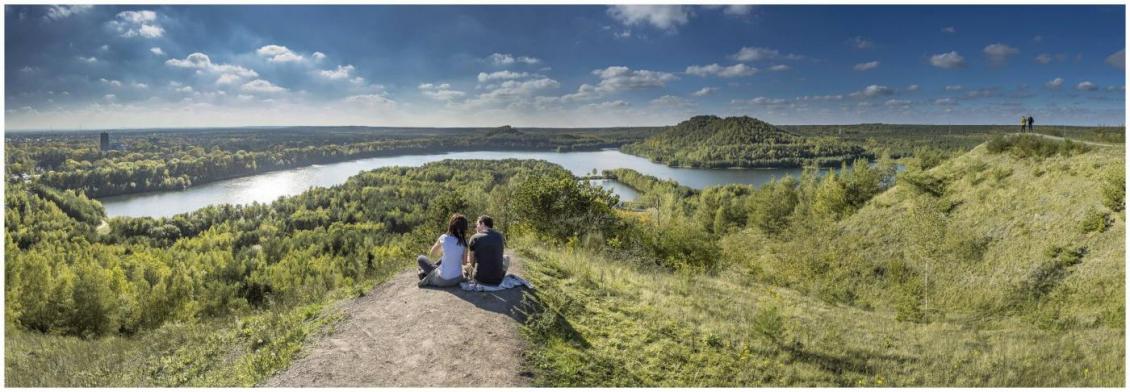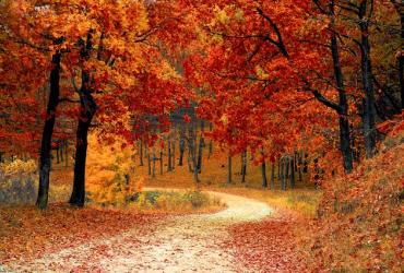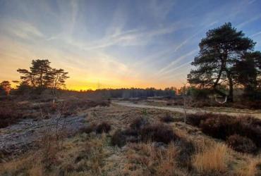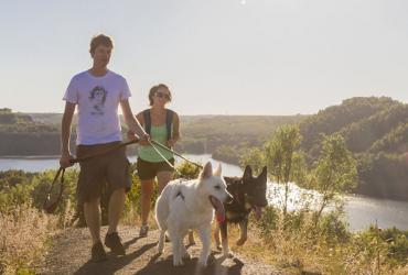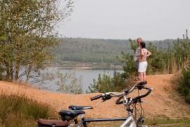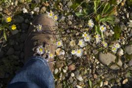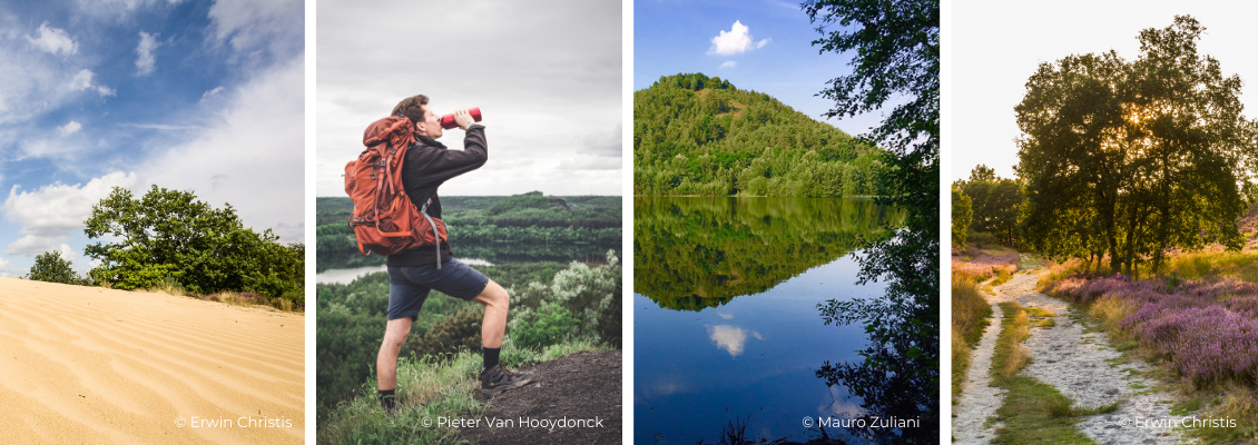
The National Park Trail is a long-distance hike of 105 km, which shows you the most beautiful spots of the Hoge Kempen National Park. The National Park Trail has a lot of surprises in store: seven climbs, extensive heathland, beautiful fens, wide open lakes, dunes and fragrant forests. It is one of the few hikes in Flanders where you will not see any buildings or traffic for more than 100 km.
The National Park Trail is freely accessible from June 2022. You can hike the 105 km as you please; you decide on the number of stages, the direction, the start and the number of kilometres. You can choose to hike the full 105 km loop or shorter variants.
The National Park Trail can be hiked in 3 ways:
- By map: An exclusive National Park topographic map will guide you along the National Park Trail. You can buy the map here for € 10.
- Signposting: The entire trail is signposted in two directions. You simply follow these signs to complete the 105 km loop.
- GPS/GPX: With the gpx-file on your hiking GPS or your smartphone.
The five basic stages
Do you really want to see all the highlights of the Hoge Kempen National Park? Then of course you have to do the whole walking loop/trail of 105 km. We advise you to split this into 4 or 5 days. We have already worked out the ideal stages for you. Each stage starts and ends at an entry gate of the Hoge Kempen National Park where all facilities are available: ample parking, information boards, toilets and catering. As well as around the entrance gates as on the trail, there are always accomodations nearby for overnight stays. There is something for everyone: hotels, campsites, B&Bs, vacation parks, pole camping, vacation homes and more. Something for everyone.
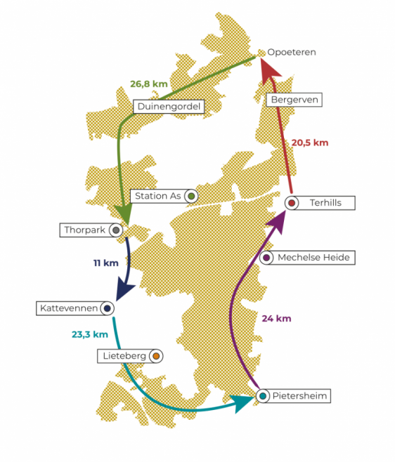
Starting route: Station GENK – KATTEVENNEN (3,8 km)
Via the Molenvijver Park and the forest you quickly reach Kattevennen, official starting point of the National Park Trail.
Stage 1: KATTEVENNEN - PIETERSHEIM (23,3 km)
You walk mainly through extensive forests on the southernmost foothills of the Kempen Plateau. The Papendaalheide and -plas provide the variation.
Stage 2: PIETERSHEIM - TERHILLS (24 km)
You walk from south to north on the edge of the Kempen Plateau, and get to know the heath landscape and the Ziepbeek valley. On the Mechelse Heide you enjoy panoramic views and the first hills.
Stage 3: TERHILLS - DUINENGORDEL (20,5 km)
Just like the previous stage, this one runs from south to north along the edge of the Kempen Plateau. You start with three climbs, and continue through the Dilser forest to Bergerven and the Bosbeek.
Stage 4: DUINENGORDEL - THORPARK (26,8 km)
You start with a series of land dunes and fens. Then you trek through heathland and forest to the mining hills of Thorpark for beautiful views.
Stage 5: THORPARK - KATTEVENNEN (11 km)
Via the Stiemerbeek valley and forest area you reach Kattevennen again.
How do you plan your route?
For the route planner we work together with our partner Komoot, the largest outdoor platform in Belgium and the Netherlands. To use our route planner on Komoot, you only need to create a free account. Our route planner gives you a clear overview of the stages and the corresponding highlights. With a simple click you can see all the facilities on the route: from drinking water facilities and shelters over toilets and bus stops to all kinds of catering establishments.
There are three ways to plan your route:
- You choose the existing basic route, divided into five stages
You can download the GPX of the entire route or you can choose a GPX per stage.
- You choose to customize the basic route to your liking
Choose the leg you want to modify from the five basic routes in the route planner below. Choose "edit a copy" and "open in planner". You will then save your own version of our basic route in your personal planner. You can modify the route to suit your needs:
• You can reverse the route to walk in the other direction. (reverse order)
• You can easily lengthen or shorten the route if you want to start/end at a different place. (drag A(start) or B(end) to the point of your choice)
• You can add an accommodation to the route so that your personal route starts or ends at the accommodation you have booked. (Drag A(start) or B(end) to the point of your choice)
• You can also cut off a piece of the route. Make sure that you do not follow the signposted route anymore. (edit the waypoint on the way to cut a route)
• Click on the "+" to add a waypoint. You will then see a list of lodging, restaurants, restrooms, drinking water spots, points of interest, parking spots, bus stops, shelters, ... not far from the National Park Trail.
Add as many points as you want, and adjust the distance and direction to suit your needs. Once you have created your personal route, you can print the overview or download the gpx. You can load the gpx into your hiking GPS (e.g. Garmin) or your hiking app on your smartphone. If you send the route/gpx to your Komoot app it has voice navigation on it by default.
- You let the route planner determine your route (multi-day tour)
Choose the number of days you want to cover the 105 km, and the route planner determines your ideal route. Add an accommodation, and your itinerary is ready:
• Click below the route planner on "View full collection on Komoot".
• Click at the first route (105km) on "customize"
• Import the route as a multi-day trip.
• Choose the number of days and add accommodation
Routeplanner