The Hoge Kempen National Park Project Bureau, commissioned by the Agency for Nature and Forests, together with the towns involved, has drawn up an accessibility scheme for the Hoge Kempen National Park.
The public investigation ran from 1 May to 31 May 2013. The regulations were officially ratified on 25 June 2014. The document and accompanying map material can be consulted here.
Summary
What is a national park?
A National Park is a nature reserve with a continuous surface area of at least 1000 ha (10km²) of typical flora and fauna. While the main function of a national park is to protect nature, a recreational dimension is possible, provided that no damage is done to nature or the landscape.
What is an accessibility scheme?
An accessibility scheme regulates accessibility for visitors, in this case for the Hoge Kempen National Park.
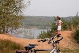
Where?
The Hoge Kempen National Park covers 512 000 ha. The scheme does not apply to private forests. The Hoge Kempen National Park is located on the territories of As, Bilzen, Bree, Dilsen-Stokkem, Genk, Lanaken, Maasmechelen, Oudsbergen and Zutendaal.
Who?
The Agency for Nature & Forest is the caretaker of the Hoge Kempen National Park and, together with the towns (for the municipal forests), is responsible for drawing up this accessibility scheme. On behalf of the ANB, the Hoge Kempen National Park project office supervised the preliminary process of the accessibility scheme. This was done via a themed 'Accessibility' group, in which, in addition to the caretaker, there was also at least one member from each of the towns involved.
Why?
The accessibility scheme will be drawn up in accordance with the Flemish Government Decree of 5 December 2008 on the accessibility of forests and nature reserves.
What is changing?
The accessibility scheme legally confirms the already existing hiking, cycling and horse-riding networks of the National Park, while outlining vulnerable zones, breeding zones, grazing zones, play zones, dog zones and an ice-skating pond.
All paths are accessible to hikers, except those located in vulnerable zones. Cyclists, mountain bikers and riders are only allowed on the designated paths of the route network intended for them.
Vulnerable areas are only accessible with the permission of the caretaker, or under the supervision of a ranger or other recognised guide. For ecological reasons, nesting areas are not accessible between 1 March and 30 June.
The standard rule 'dogs are welcome, but always on leash' is maintained. This rule is tightened in the grazing areas, since dogs are not allowed, not even on a leash in those areas. This rule is relaxed in the dog zones. Dogs are allowed off the lead here. Four dog zones are delineated near the ‘Kikbeekbron’, the 'Mechelse Heide' and ‘Neerharenbos’.
The existing playing areas will be retained, only the play area 'under the hill' (Maasmechelen) and 'bosheide' (As) will be removed.
Part of the ‘Aspermansvijver’ is demarcated as a skating pond. Ice-skating is only permitted when rubber-stamped by the fire brigade.