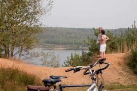
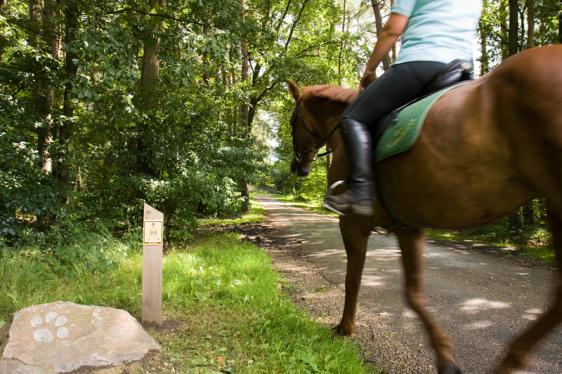
Horseback riding in the Hoge Kempen National Park
As many as 198 km of bridle and horse trails run through the National Park. About 85 per cent of these are unpaved.
The network of bridle and bridle paths consists of a junction system so that you can put together your own tour.
From horse-friendly accommodation and catering establishments or riding stables, you can start for your own composed tour. There are resting points and accommodation along the route. Not sure where to start? Then go for our Droomroute Duinengordel or Vierlandsheren-tocht.
Find our riding lodges here!
3 ways to choose your route for a horseback ride through the Hoge Kempen National Park
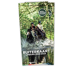
- Use the riding map of Toerisme Limburg. You can take it with you for free at these places or download it in pdf.
- You follow one of our suggestion routes such as the Droomroute Duinengordel or the Vierlandsheren-tocht. You then download the GPX to follow the route or follow the nodes on the posts in the National Park.
- You create your own route using the route planner at the bottom of this page. Click on the equestrian nodes and download or print your own route. Or follow the nodes on the posts.
Choose your suggestion route below:
- In the north of the park near Oudsbergen, Maaseik or Bree: the Droomroute Duinengordel
- In the south of the park near Lanaken, Zutendaal, Bilzen and Maasmechelen: the Four Countrymen Tour
Suggested route: Duinengordel dream route
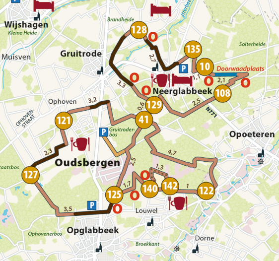
- Junctions 135 - 10 - 108 - 129 - 41 - 122 - 142 - 140 - 125 - 127 - 121 - 41 - 129 - 128 - 135
- Distance: 31 km
- Starting points: Orshof, Sentower Park or Blueberry Joiners
- You will find resting points on the route such as Camping Zavelbos between nodes 122 and 142, ‘T Goed Geluk between nodes 121 and 127 or a nice (picnic) bench
- Landscape: you trek through Duinengordel, the northern part of the Hoge Kempen National Park. Gallop through the sand between nodes 140 and 142 with a view of the Oudsberg, the highest land dune in the country. Besides the loose sand of the dunes, you'll find experiential obstacles and a splashy ford.
Suggested route: Vierlandsheren-tour
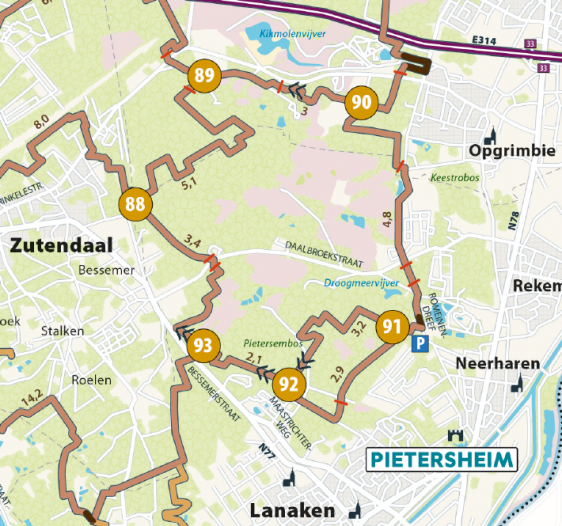
- Junctions 91 - 92 - 93 - 88 - 89 - 90 - 91
- Distance: 21 km
- Starting point at the Foresta restaurant car park, Paalsteenlaan 94, Lanaken. There is limited space for trailers here. Or starting point Pietersheim with ample parking for trailers, but with an approach route
- Several rest points on the route
- Landscape: dirt roads, deciduous and pine forests, ponds, ...
Plan your own route with the equestrian nodes
How to proceed
With the handy route planner, you can create your own route in no time. We explain in a short step-by-step plan how to proceed:
-
Zoom in or out on the map below or use the 'search' field to go to your starting municipality
-
Click on the equestrian route network in the place where you want to start
-
Then click on the places where you want to ride or drive with your horse, pony or bridle
(The route runs in the direction indicated on the map. It corresponds to the direction of the signposting on the terrain) -
If the route diverts you too far, you can turn off the routing and cut off sections by choosing manual. When you are back on the network, choose "equestrian and men's route network" again as the route option to continue.
-
When you are almost at the end, you can choose "Back to starting point" to close the loop.
-
Select "Save route" or "Print your route" to download and print.
Note that when you save your route (point 6), the route is made public via the RouteYou website. By using the route planner, you give permission for this.
Good to know
- Both riders and drivers are welcome on all trails.
- Ash systems allow single, double, and four-horse carriages to pass through.
- In winter, some sections can be boggy and some experience as a driver is desirable.
- Here and there your path runs together with a hiking and/or cycling path. Give them the right of way, as not everyone feels safe near a horse.
- Due to forest clearing, agricultural use,... we can't guarantee that the roads are equally good everywhere.
- There are no horses for hire. You always bring your own horse.
Info on horse-friendly accommodation in and around the National Park can be found here.